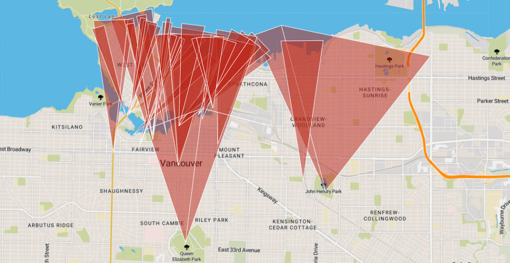
Vancouver city councilors have unanimously approved a motion calling for a review of the city’s protected “view cones,” which have restricted developments in many parts of Vancouver and helped exacerbate the housing crisis. There are 26 view cones that cross over Vancouver’s central areas of the downtown Vancouver peninsula and the Central Broadway area, as well as the northern areas of East Vancouver.
Since 1989, the City of Vancouver View Protection Guidelines has implemented more than two dozen views cones, limiting the location and design of new buildings and often resulting in developments that are reduced in height or size.
The motion asks staff to review protected view corridors showcasing the North Shore mountains, downtown skyline and surrounding water, and figure out how much housing, office space and amenities such as parks could be built in places where the view cones have become dated or have limited value.
This is especially the case for the Broadway Plan where there is the potential to significantly expand and enhance the Vancouver core. Many locations along Broadway are limited to the Queen Elizabeth View Cone, which is only visible from the top of Queen Elizabeth Park on days when the weather is clear and not raining.
Full report in the link below: